CryoSat
Jump to: Mission Objectives, Mission Instrumentation, Mission Parameters, Additional Information
Mission Photos:
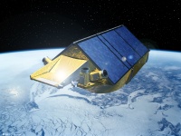
Courtesy of ESA
Mission Objectives:
A mission to measure change in the cryosphere, CryoSat-2 will measure the thickness of sea-ice and the surface elevation of ice sheets in both Northern and Southern hemispheres. For this, it uses an advanced radar altimeter combined with Precise Orbit Determination.
As the mission is intended to measure small secular change in a measure of distance it is necessary to use laser ranging for:
- calibration of the altimeter and
- support to the POD
The latter will primarily be performed with DORIS, but the SLR measurements will provide an essential independent tracking data type.
Unfortunately, the CryoSat-1 satellite was lost due to a launch failure on October 8, 2005 (ESA news release). CryoSat-2, identical to CryoSat-1, launched successfully on April 8, 2010 (ESA news release).
Mission Instrumentation:
CryoSat will have the following instrumentation onboard:
- SAR/Inteferometric Radar Altimeter (SIRAL)
- DORIS receiver
- Retroreflector array
- Three star trackers
Mission Parameters:
| Satellite: | CryoSat-1 | CryoSat-2 |
| Sponsor: | ESA | ESA |
| Expected Life: | 3 years | 3 years |
| Primary Applications: | measure ice thickness | measure ice thickness |
| Primary SLR Applications: | precision orbit determination | precision orbit determination |
| COSPAR ID: | N/A | 1001301 |
| SIC Code: | N/A | 8006 |
| Satellite Catalog (NORAD) Number: | N/A | 36508 |
| Launch Date: | October 8, 2005 | April 08, 2010 |
| NP Bin Size: | 15 seconds | 15 seconds |
| RRA Diameter: | 16 cm | 16 cm |
| RRA Shape: | hemispherical | hemispherical |
| Reflectors: | 7 corner cubes (Meteor design) | 7 corner cubes (Meteor design) |
| Orbit: | circular, non sun-synchronous | circular, non sun-synchronous |
| Inclination: | 92 degrees | 92 degrees |
| Eccentricity: | 0.0 | 0.0 |
| Altitude: | ~720 km | ~720 km |
| Weight: | 711 kg | 711 kg |
Additional Information:
- Cryosat-2 Quaternion Product: file format specifications
- Reflected wavefront measurement of Cryosat LRR module
- CryoSat-LRR-01 Laser Retro Reflector Technical Description
- Montenbruck, O. and R. Neubert, Range Correction for the CryoSat and GOCE Laser Retroreflector Arrays
- Cryosat-2: “Characteristics for DORIS Calibration and POD Processing (Version 0.5)”. CNES document provided by the International DORIS Service (IDS)
- Cryosat-2 Product Handbook (ESA Document C2-LI-ACS-ESL-5319)
Cryosat Press Releases:
- "Life beyond the leak for Cryosat", ESA, November 22, 2023
- "Cryosat reveals ice loss from glaciers", ESA, April 26, 2023
- "Ice loss from Greenland and Antarctica hits new records", ESA, April 23, 2023
- "Cryosat still cool at 10", ESA, April 8, 2020
- "Cryosat reveals secrets of the deep", ESA, October 3, 2014
Cryosat-2 science & spacecraft-related videos:
- "ESA's CryoSat mission reveals 10 years of glacier ice loss", ESA, April 26, 2023
- "CryoSat - A Decade of Polar Altimetry with [Professor] Andrew Shepherd", International Space Science Institute (ISSI), February 4, 2021
- "Demystifying Antarctica: What we have learned from the past 100 years of observations, and what comes next", with Professor Helen A. Fricker (Scripps, UCSD), International Glaciological Society Seminar Series [repeat of 2019 American Geophysical Union Nye Lecture], July 7, 2020
- "Draining the Ocean Basins with CryoSat-2", Scripps Institute of Oceanography, October 3, 2014
- "Cryosat-2 satellite orbit and attitude depiction", International DORIS Service (IDS), April 5, 2016
Web sites:
Publications:
- General mission reference:
- Parrinello T., Shepherd A., Bouffard J. et al.. (2018). “CryoSat: ESA’s ice mission – Eight years in space”, Adv. Space Res., 62(6), 1178–1190, doi: 10.1016/j.asr.2018.04.014
- SLR and POD-related papers:
- Moyard J., Couhert A., Mercier F. et al. (2019). "CNES POE-F precise orbit performances for the current altimeter missions", Presentation at the 2019 Ocean Surface Topography Science Team (OSTST) Meeting, Chicago, Illinois, Oct. 21–25, 2019
- Rudenko, S., Dettmerring D., Bloßfeld M. et al. (2023). "Radial orbit errors of altimetry satellites", Surveys in Geophysics, 44(3), 705–737, doi: 10.1007/s10712-022-09758-5
- Schrama E.J.O. and Visser P. (2022). "Orbit accuracy on the 12th anniversary of the Cryosat-2 mission", presentation at the 2022 International DORIS Service (IDS) Workshop, Oct. 31 – Nov. 2, 2022, Venice, Italy, doi:10.2440/312072/i03-2022.3313
- Schrama E.J.O. (2018). "Precision orbit determination for CryoSat-2", Adv. Space Res., 61(1), 235–247, doi: 10.1016/j.asr.2017.11.001
- Selected Cryosat-2 Science-related papers:
- Cryosphere:
- Jakob L., Gourmelen N. (2023). "Glacier mass loss between 2010 and 2020 dominated by atmospheric forcing", Geophys. Res. Lett., 50(8), e2023GL102954, doi: 10.1029/2023GL102954
- Jakob L., Gourmelen N., Ewart M., Plummer S. (2021). "Spatially and temporally resolved ice loss in High Mountain Asia and the Gulf of Alaska observed by CryoSat-2 swath altimetry between 2010 and 2019", Cryosphere, 15(4), 1845–1862, doi: 10.5194/tc-15-1845-2021
- Liu S.W., Jiang J.H., Sun Q.T. et al. (2023). "Assessment of the Greenland ice sheet change (2011-2021) from CryoSat-2", Polar Science, 36, doi: 10.1016/j.polar.2023.100940
- Nilsson J., Gardner A.S., Paolo F.S. (2022). "Elevation change of the Antarctic Ice Sheet: 1985 to 2020", Earth System Science Data, 14(8), 3573–3598, doi: 10.5194/essd-14-3573-2022
- Schröder L., Horwath M., Dietrich R. et al. (2019). "Four decades of Antarctic elevation changes from multi-mission satellite altimetry", Cryosphere, 13(2), 427–449, doi: 10.5194/tc-13-427-2019
- Zhang B.J., Wang Z.M., Yang Q.M. et al. (2020). "Elevation changes of the Antarctic ice sheet from joint Envisat and CryoSat-2 radar altimetry", Remote Sensing, 12(22), doi: 10.3390/rs12223746
- Sea ice thickness & mapping:
- Dawson G., Landy J., Tsamados M. et al. (2022). "A 10-year record of Arctic summer sea ice freeboard from CryoSat-2", Remote Sensing of Environment, 268, doi: 10.1016/j.rse.2021.112744
- Meier W.N and Stroeve J. (2022). "An assessment of the changing arctic sea ice cover", Oceanography, 35(3-4), doi: 10.5670/oceanog.2022.114
- Bathymetry & gravity mapping:
- Bergé-Nguyen M., Crétaux J.F., Calmant S. et al. (2021). "Mapping mean lake surface from satellite altimetry and GPS kinematic surveys", Adv. Space Res., 67(3), doi: 10.1016/j.asr.2020.11.001
- Gevorgian J., Sandwell D.T., Yu Y. et al. (2023). "Global distribution and morphology of small seamounts", Earth and Space Science, 10(4), doi: 10.1029/2022EA002331
- Sandwell, D.T., Harper H., Tozer B., Smith W.H.F. (2021). "Gravity field from geodetic altimeter missions", Adv. Space Res., 68(2), doi: 10.1016/j.asr.2019.09.011
- Sandwell D.T., Müller R.D., Smith W.H.F. et al. (2014). "New marine gravity model from CryoSat-2 and Jason-1 reveals buried tectonic structure", Science, 346(6205), 65–67, doi: 10.1126/science.1258213
- Tozer B., Sandwell D.T., Smith W.H.F. et al. (2019). "Global bathymetry and Topography at 15 Arc Sec: SRTM15+", Earth and Space Science, 6(10), 1847–1864, doi: 10.1029/2019EA000658
- Ocean products:
- Andersen O.B. Rose S.K., Abulaitijiang A. et al. (2023). "The DTU21 global mean sea surface and first evaluation", Earth System Science Data, 15(9), 4065–4075, doi: 10.5194/essd-15-4065-2023
- Banks C.J., Calafat F.M., Shaw A.G.P., et al. (2023). "A new daily quarter degree sea level anomaly product from CryoSat-2 for ocean science and applications", Scientific Data, 10(1), doi: 10.1038/s41597-023-02300-1
- Naeije M., Bouffard J. (2021). "Long-term quality and stability assessment of CryoSat-2 Ocean Data", Adv. Space Res., 68(2), 1194–1215, doi: 10.1016/j.asr.2019.08.039
- Prandi P., Poisson J-C., Faugère Y. et al. (2021). "Arctic sea surface height maps from multi-altimeter combination", Earth System Science Data, 13(12), 5469–2021, doi: 10.5194/essd-13-5469-2021
- Ocean tide modelling:
- Andersen O.B., Rose S.K., Hart-Davis M.G. (2023). "Polar ocean tides – revisited using CryoSat-2", Remote Sensing, 15(18), doi: 10.3390/rs15184479
- Ray R.D. and Zaron E. (2016). "M2 internal tides and their observed wavenumber spectra from satellite altimetry", J. Physical Oceanography, 46(1), 3–22, doi: 10.1175/JPO-D-15-0065.1
- Zaron E. (2019). "Simultaneous estimation of ocean tides and underwater topography in the Weddel Sea", J. Geophys. Res.-Oceans, 124(5), 3125–3148, doi: 10.1029/2019JC015037
- Global & regional mean sea level change:
- Rose S.K., Andersen O.B., Passoro M. et al. (2019). "Arctic ocean sea level record from the complete altimetry era: 1991–2018", Remote Sensing, 11(14), doi: 10.3390/rs11141672
- Veng T and Andersen O.B. (2021). "Consolidating sea level acceleration estimates from satellite altimetry", Adv. Space Res., 68(2), 496–503, doi: 10.1016/j.asr.2020.01.016
- Terrestrial Reference Frame:
- Moreaux G., Lemoine F.G., Capdeville H. et al. (2023). "The International DORIS Service contribution to ITRF2020", Adv. Space Res., 72(1), 65–91, doi: 10.1016/j.asr.2022.07.012
- Moreaux G., Lemoine F.G., Zelensky N.P. et al. (2023). "DPOD2020: A DORIS extension of the ITRF2020 for precise orbit determination", Adv. Space Res., 72(11), 4625–4650, doi: 10.1016/j.asr.2023.10.006
- Cryosphere: