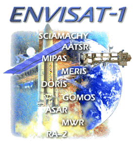
Envisat-1
Jump to: Mission Objectives, Mission Instrumentation, Mission Parameters, Additional Information
Mission Photos:

Courtesy of European Space Agency
Mission Objectives:
The Environmental Satellite (Envisat)-1 is the successor to the European Space Agency (ESA) Remote Sensing Satellites ERS-1 and ERS-2. The satellite will provide continuity with most of the ERS-1 and -2 measurements and adds significant new capabilities. The satellite was launched in early 2002 and with a 5-year operational life, the mission will support the provision of long term data sets which are essential for both operational application of spaceborne remote sensing systems and climatological and environmental research.
The objectives of the Envisat-1 mission are intended to support the monitoring and studying of the Earth's environment and climate changes; the management and monitoring of the Earth's resources, both renewable and non-renewable; and the development of a better understanding of the structure and dynamics of the Earth's crust and interior.
Mission Instrumentation:
To meet the mission requirements a coherent, multidisciplinary set of sensors has been selected. Each instrument, with its distinct measurement capabilities, contributes to the mission. The instruments have been selected to supports synergism between their measurements and between scientific disciplines, thus making the total payload complement more than just the sum of the instruments. The instruments are:
- Michelson Interferometer for Passive Atmospheric Sounding (MIPAS)
- Global Ozone Monitoring by Occultation of Stars (GOMOS)
- SCanning Imaging Absorption spectrometer for AtMospheric CartograpHY (SCIAMACHY)
- MEdium Resolution Imaging Spectrometer (MERIS)
- Advanced Along Track Scanning Radiometer (AATSR)
- Advanced Synthetic Aperture Radar (ASAR)
- Radar Altimeter 2 (RA-2)
- MicroWave Radiometer (MWV)
- Doppler Orbitography and Radiopositioning Integrated by Satellite (DORIS)
- RetroReflector Array (RRA)
Mission Parameters:
| Sponsor: | European Space Agency |
| Expected Life: | 5 years |
| Primary Applications: | remote sensing and environmental monitoring |
| Primary SLR Applications: | POD |
| COSPAR ID: | 0200901 |
| SIC Code: | 6179 |
| Satellite Catalog (NORAD) Number: | 27386 |
| Launch Date: | 1 March 2002 |
| NP Bin Size: | 15 seconds |
| RRA Diameter: | 20 cm |
| RRA Shape: | hemispherical |
| Reflectors: | 9 corner cubes |
| Orbit: | circular, sun-synchronous polar |
| Inclination: | 98.54 degrees |
| Eccentricity: | 0.001165 |
| Perigee: | 796 km |
| Period: | 100 minutes |
| Weight: | 8211 kg |
Additional Information:
Web sites:
- European Space Agency (ESA)
- Archiving, Validation and Interpretation of Satellite Oceanographic data (AVISO)
- Weekly HTSI Tracking Reports
Publications:
- Femenias, P.F., "ESA EO Envisat and Cryosat Missions Status (Poster)", 14th International Laser Ranging Workshop, San Fernando, Spain, June 7-11, 2004.", 14th International Laser Ranging Workshop, San Fernando, Spain, June 7-11, 2004.


